The day when Election Commission of Pakistan (ECP) uploaded election nominees details on their website, i could not stop myself from exploring the details of contestants and political constituencies in the country. While a lot of concerns are being shown about the quality of documents and to the extent to which they enable the citizen to explore financial / tax details of the politicians; i was particularly interested to see the political constituency maps and the level of detail in the political area boundaries. This issue is particular important in big cities of the country like Karachi and Lahore, where demarcation and amendment of political boundaries has become a bone of contention between major political parties, government & Supreme Court. At least in my experience, this is The first time that such maps have been uploaded for general public in the country. The website of ECP was overwhelmingly burdened with the traffic as nearly 50,000 views per hour were reported in media on that day. While i downloaded one National Assembly Constituency Map, I was rather disappointed to see the quality of product which appeared to be rather ill drawn and distorted. I place one map image below as an evidence.
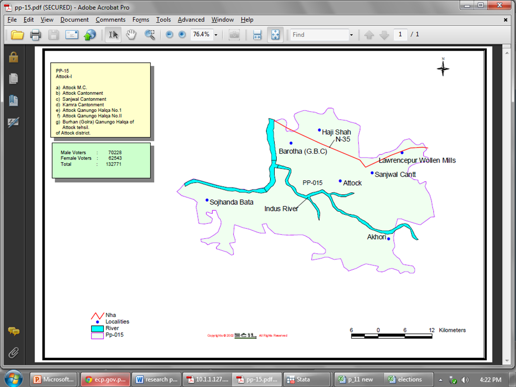
Political boundary map showing PP-15 area surrounding Attock City
Source: http://ecp.gov.pk/Delimitation/ConstituencyMap/pp-15.pdf
Well, for a layman, it is a map showing the boundary of PP-15, but for a more informed person who can read the map and would like to identify the boundary on ground, there is a little help from the map. I am surprised at the map making skills of the consultants, who have proudly presented their Logo on the map, it seems a job rather poorly done. Even a graduate student in GIS can produce a map much more better quality than this. I recognize that these maps were drawn in year like 2002, but still, the principles of mapping remain the same since fifty years or so. While ECP could have updated these maps (updated, not changed), i was unable to export the map into image format after i downloaded the pdf file of the page. This map teaches well that how to make Sketches through GIS. It even cannot be compared with Land Revenue maps of the country which date back to 1950s. Well I would grade land revenue maps better than these GIS maps; at least land revenue maps have more information than these sketches. While International mapping agencies are continuously doing well in GIS mapping in Pakistan, government potential for mapping remains as low as before. Recently, i read somewhere about the education GIS project in Sindh Province with the help of USAID, i wish same effort would have been done in these important maps, which can help improving the transparency and fairness of electoral process in the country. I would like to lodge on online petition for the quality of these maps as they can misguide more easily than guiding the voters and politicians in the country.
 RSS Feed

