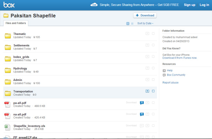
I plan to upload my GIS datasets for everyone and soon you will be able to download Pakistan GIS shapefiles from a permanent link. Sole aim is to improve access to national data, collaboration between its users and the quality work in Pakistan
Access data via box link https://www.box.com/signup/collablink/d_822433060/38cea1557bc3e
Total Pak areas: admin 1 to admin 4, land use, settlements etc,
- Everone will be able to access and download dataset from Box.com. I will post data link as soon as it is finished uploading. Few images of ongoing work are pasted below:-
- Source: Mainly downloaded from web, produced by national and international mapping agencies/departments. Its meta data will tell about the producer, if not, you can contact me further
Total Pak areas: admin 1 to admin 4, land use, settlements etc,
- Selected Pak areas: admin 5 and admin 6: flood affected area mapping
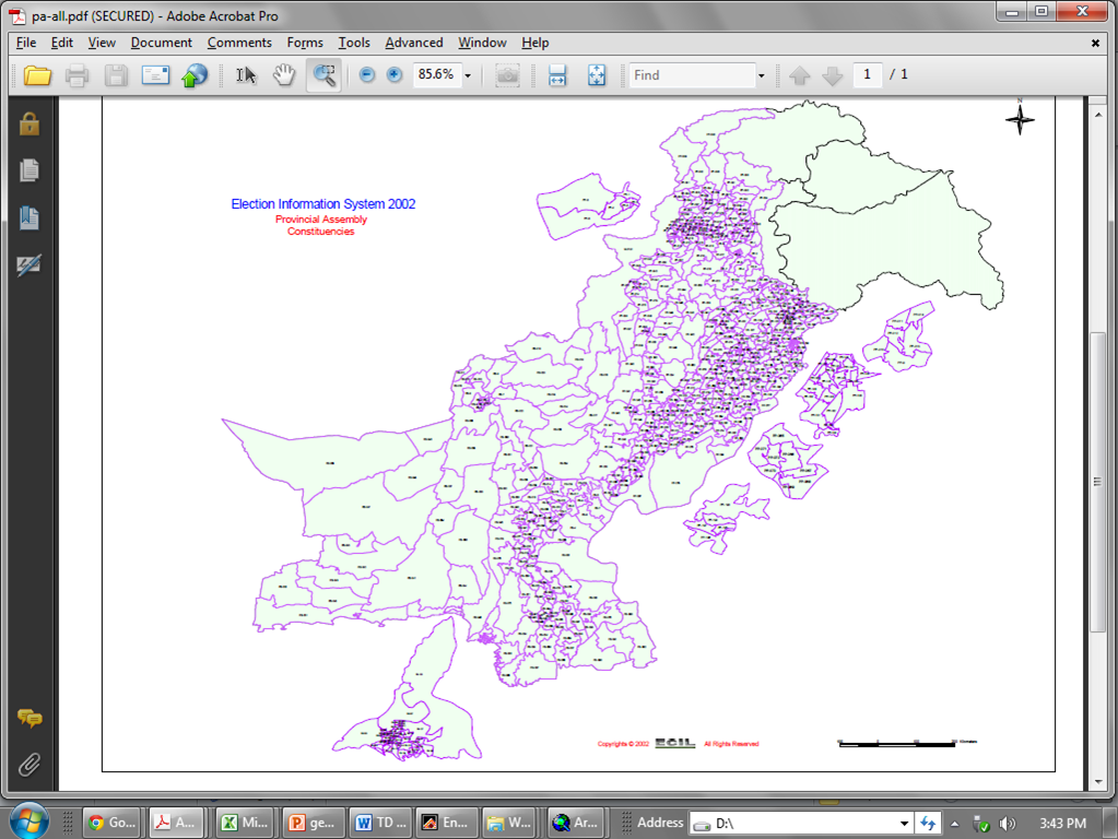
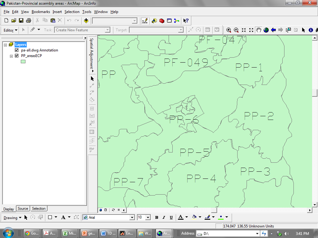
- Election 2013: .pdf files, CAD converted boundaries with names
future place to share the data online - upload is in progress, i will publish its link soon
PP boundary map with names
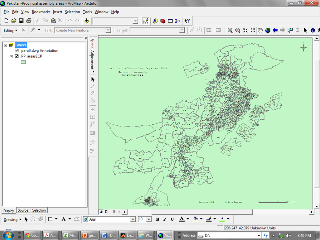
PP Boundary Map converted from pdf to CAD file online
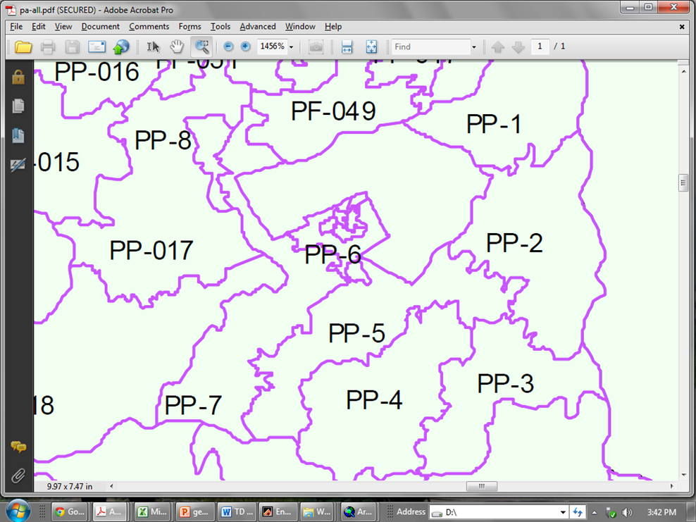
PP Boundary Map in pdf...zoomed in view; the map gets distorted in CAD file due to resolution issues
CAD conversion of PP Boundary maps
 RSS Feed

