According to the Pakistan's Delimitation of Constituencies Act, 1974, the constituencies for elections to the National and Provincial Assemblies (would be mentioned as NA and PP respectively) are delimited after every census. As the census was carried out in 1998 , the constituencies were delimited in previsions 2007-08 elections but their accurate boundary maps have not been generated so far. After Election Commission of Pakistan (ECP) unveiled Pakistan's political Constituency maps for Election 2013, there are three good reasons why now we should look to map NA and PP boundaries in GIS…
1.Because the known ECP boundaries made in year 2002-2004 are a mess (available here and here) ; and now we have good data on Provincial, District and Tehsil boundaries and for some areas Union Council and Moza level boundaries too (available here)
2.Because no one cares for good looking and reliable GIS maps other than students and some GIS fortune hunters (Again many of them would be GIS students)
3. A good effort done by someone has NA locations in point file... well, it should be in reliable polygons for all purposes and for media too... or if you already have it, that will be good to see.
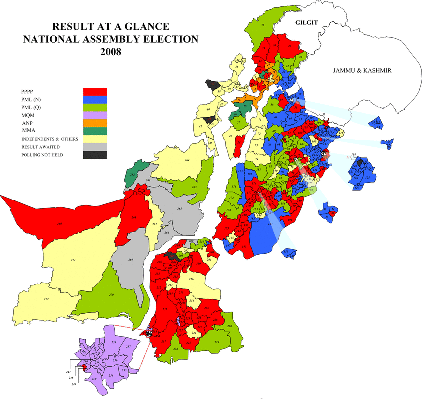
The best existing source of Pakistan's NA and PP boundary map, so far i found is here , i paste it below
1.Because the known ECP boundaries made in year 2002-2004 are a mess (available here and here) ; and now we have good data on Provincial, District and Tehsil boundaries and for some areas Union Council and Moza level boundaries too (available here)
2.Because no one cares for good looking and reliable GIS maps other than students and some GIS fortune hunters (Again many of them would be GIS students)
3. A good effort done by someone has NA locations in point file... well, it should be in reliable polygons for all purposes and for media too... or if you already have it, that will be good to see.
The best existing source of Pakistan's NA and PP boundary map, so far i found is here , i paste it below
How to map GIS shapefiles of Pakistan's NA and PP boundaries ?
–See the rules and basis that define areas: this is very important as accuracy and reliability of results ( complex, and difficult to assess how a district is divided into NA and PP areas, which are available here
–Take help from ECP’s list of NA , PP areas by districts; available here
–Get the administrative shape files ready; available here
–Try to take the ‘legendary’ first ever constituency boundaries from ECIL or its employees, if they have not crashed their hard-disk yet.
–Register the old constituency map image available here on Pak admin files (its reliability as a base map is question mark, although it looks quite decent, better to ask the owner about its source)
–Overlay and try to trace raster into polygons
–Try to ‘adjust’ the boundaries …
It may not be an ideal solution but will be better than none at all or a point location of NA and PP areas of the country. there is some margin of using dist boundaries. Many districts of Baluchistan are marked as NA boundaries, it will be a good idea to see the rule how NA boundaries follow by districts; at least for some areas, NA boundaries are possible easily. See the lower left side of above map. Good luck. And if it works well / you make a fortune, share your story with all of us. Share your ideas and expert opinion of how to get out of this trouble of locating NA and PP areas on regular shapefile database of Pakistan. Well, all the writing turned out to be little unrealistic, after i found the said boundaries here and here. so now just enjoy the writing, but use the boundary files given by ECP.
 RSS Feed

